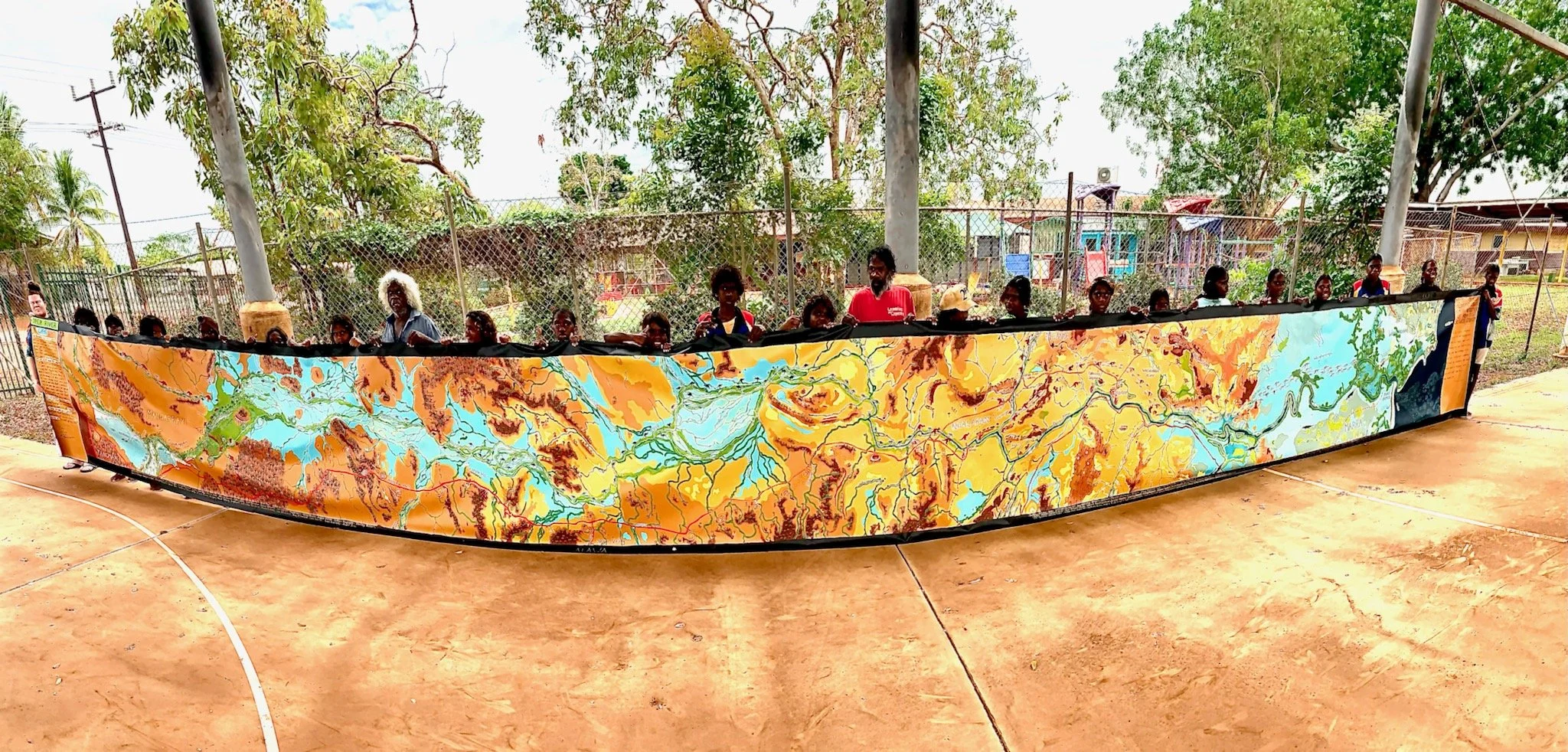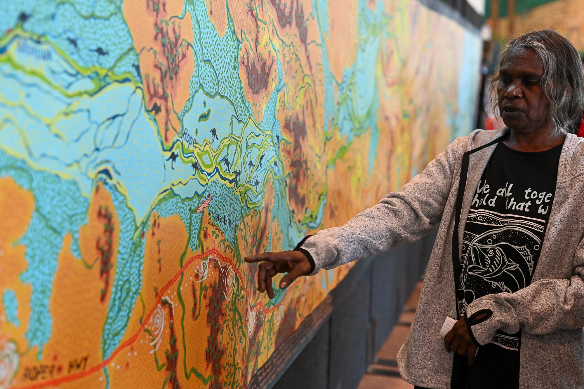
The Roper River map
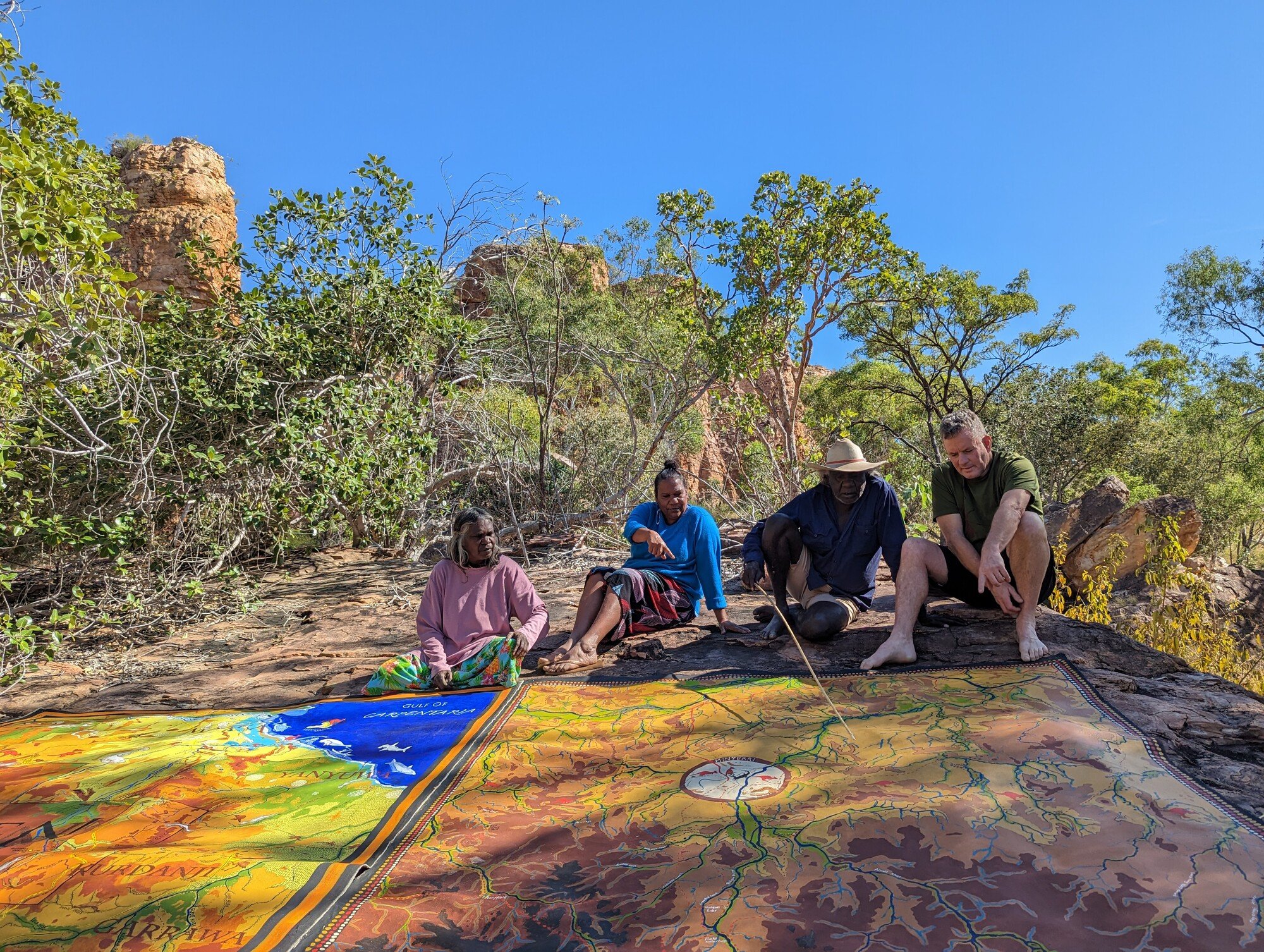
The Roper River Songlines map project began in 1996 when elders from south-east Arnhem Land asked for their cultural knowledge, stories and connections to Country to be recorded for future generations.
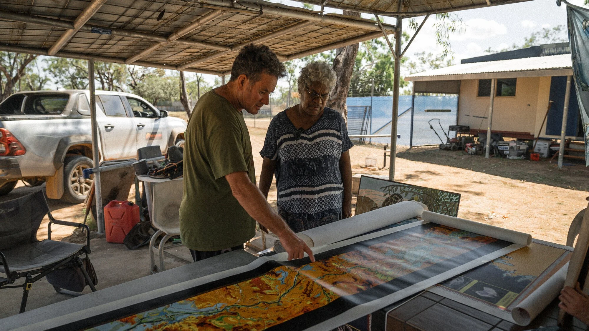
Over nearly 30 years, Traditional Owners from communities across the Roper and Gulf regions worked with artist Simon Normand to map songlines, waterways and Country.
In 2023, Traditional Owners from the Roper River catchment travelled to the Australian Parliament to ask for protection of the river from threats posed by new water intensive industries in the catchment and to be at the forefront of decision-making for the river. Representatives presented a 13-metre hand-painted cultural map and associated statement signed by hundreds of remote community residents.
This map now stands as a powerful statement calling for the protection of the Roper River and its life-giving waters for future generations.
Cecilia Lake talks to ABC News as she travels to Canberra to talk to Parliament.
The Roper River map arrives in Canberra, to be presented to Australian politicians.
View the full roper river map
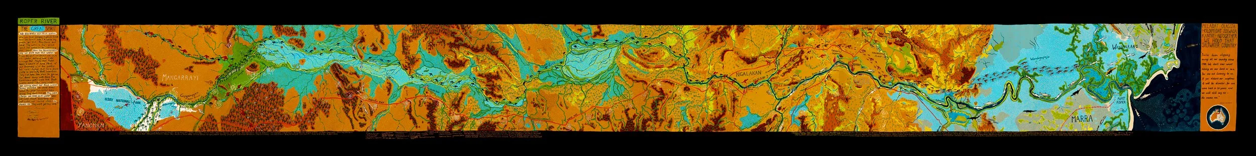
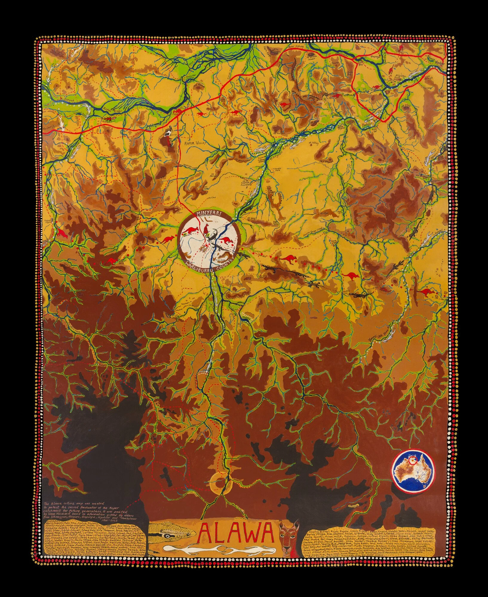
The Roper River Map was produced by artist Simon Normand, in collaboration with Traditional Owners from across the Roper River catchment.